Leaving Norseman to travel east on the Eyre Highway is leaving WA – not the state border of course, which is 720 km to the east, but in terms of settlement and sentiment. When people say “crossing the Nullarbor” they generally mean the 1100 km plus between Norseman and Penong even if the highway only crosses a short section of that vast vegetation system correctly identified as the Nullarbor. That larger distance defines the space between the last and first towns, the respective edges of the western and eastern Australian reticulated electricity grids, and any attempt at agriculture beyond sheep grazing of the native vegetation. The roadhouses along the way that keep people and vehicles fuelled and accommodated have not grown into towns over the nearly 50 years since David first hitchhiked “across the Nullarbor” in 1971 (despite Australia’s population having doubled in that time). The major changes for travellers since then have been the completion of the bitumen on the last 100km or so of unsealed road on the South Australian side of the border (a few years later) and of course mobile phone tower communications (much more recently). The change in land use since those days does include optimistic grain cropping reaching out to Nundroo despite the drying climate.

Classic image of the Nullarbor with the warnings about native and naturalised wildlife
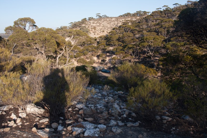
After packing up Sunday morning at Jimberlana Hill camp and saying goodbye to Graham, who was heading north to Kalgoorlie for another bush rendezvous with an old friend, we headed east for what turned out to be one of the longest days driving of the trip – 527 km to the Madura escarpment. Early in the trip we did stop to harvest a leg off a freshly killed (and cooled by the night air) large male kangaroo. We arrived at the dramatic Madura escarpment, drove into the roadhouse, noted the Madura Oasis caravan park under the large trees at the foot of the escarpment but headed back out to look for a bush camp. In the absence of any phone service to use Google air photos we were followed our noses along an overgrown sealed road up a gully in the limestone escarpment opposite the roadhouse. We noted a flat sheltered campsite in old roadside quarry, continued on to the top of the escarpment where dirt roads headed off in four directions from the end of the bitumen. We found an accessible track that lead to a few large trees with views over the plain below (and more dry accessible firewood of the perfect size than we could have consumed in a month). Shelter was a bit marginal and it had been windy all day. Su favoured going back to the quarry near the highway, David thought this spot was too good to leave. In the absence of a wind forecast we flipped a coin and head back down to the quarry, which was nestled between the limestone rock slopes with a healthy scattering of saltbush, acacias, melaleucas and eucalypts.
The view from the escarpment above the camp
David sliced a section off the kangaroo leg to do a flash fry but in the process of removing the sinews from the folds of dark red meat confirmed this was the toughest old male he had ever butchered. Su suggested a longer cooking stew with root vegetables, which was delicious after an hour cooking. After dinner David completed the skinning of the leg for overnight hanging in the camper, but in the process of removal of the toughest outside sinews was dismayed to see tapeworms in the layers of sinew attachment to the leg bone. Although cooking makes meat safe, stories of getting sick from bush meat, thoughts about contamination of utensils and skin grazes and a more general preference for not consuming meat from sick animals had us donate what for millions of people around the world would be prime meat to the resident ravens, which in any case live off road kill, whether so tastefully prepared or just made accessible on the highway by 36 wheelers.
The wind did come up in the night, with lightening flashing away to the south but so distant there was no thunder. We were thankful the flip of the coin had selected the most sheltered site.
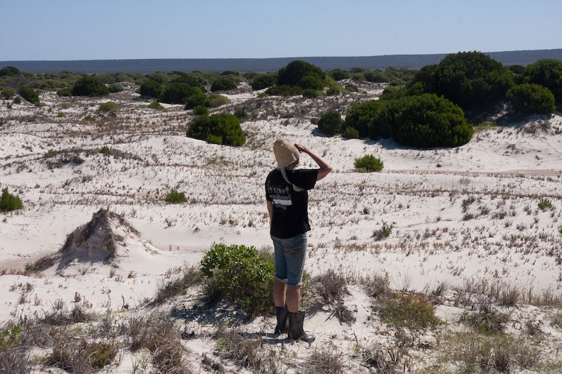
Exploring the escarpment slope in the morning, David wondered why the lichens on the light grey limestone rocks were all pure white, a very inefficient colour for a photosynthesising lifeform. Maybe the environment is so bright and hot that white is necessary for survival.
The camp getting the first rays of morning sun with the white lichen looking like someone has been out with the whitewash
200 km east along the foot of the escarpment, the sand dunes of the Eucla Telegraph station came into view and we decided to take an unmarked track to the coast. After corrugations a bit severe for The Blue, and eventually a sand drift, we parked and walked towards the beach but eventually the view from a high dune and the cold onshore wind changed our minds.
Su on the coastal dunes looking east toward the Nullarbor escarpment at Eucla
Su went back to the car to read but David was drawn like a desert traveller to a mirage, towards the Tuart tree on the skyline that he remembered from 1999 growing next to the abandoned state-of-the-art communication infrastructure this country build in the 19 th century. The exotic vigour of the massive spreading Tuart, perhaps the age of the ruin, in the salt windswept dunes (destabilised by rabbit plagues In the 1890s), and the rusting steel poles of the telegraph line symbolised a theme of David’s work: that the movement of plants, especially trees, may be a longer lasting legacy of global civilisation than our technology and constructions.
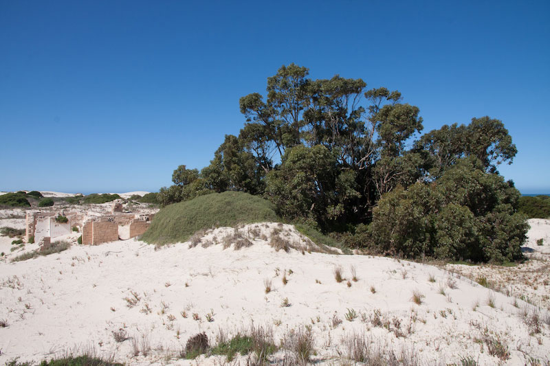
The ruin of the Telegraph Station sheltered by the massive spreading Tuart
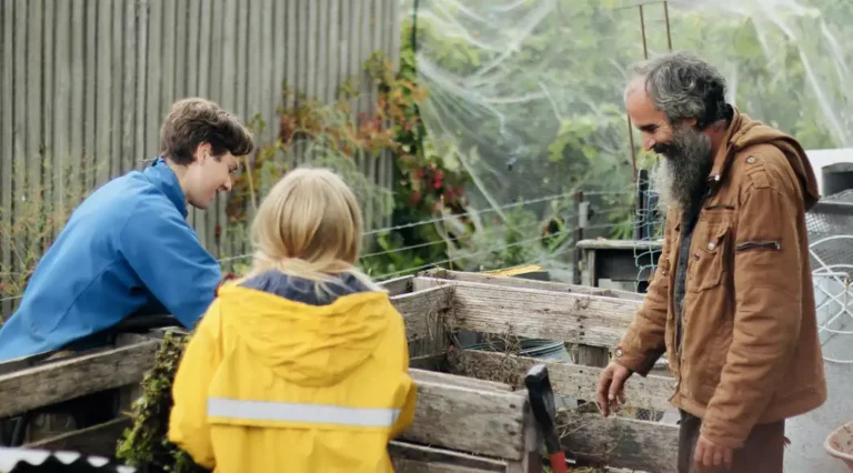
Back on the highway, across the border and the true Nullarbor, we took two short stops at the spectacular cliff edges. Camp that night was in the lee of spreading Eucalyptus on the first of the limestone ridges that form the country east of the Nullarbor plain. After a calm night with a few spots of rain like the previous evening we journeyed east past the Yalata aboriginal settlement, one of the few prominent markers of indigenous presence on the highway named after a white explorer. At Nundroo the crops were barely 150mm tall and we wondered whether rain would be too late to make much difference. Our lunch stop to eat our last fresh vegies before the SA quarantine check had more bush flies than either of us remember and a temperature hitting 30 degrees.
Ceduna foreshore was a breath of fresh air, a swim in the calm waters Murat Bay, a chat to local aboriginal women speaking Pitjantjara amongst themselves eating chips on the grass and a walk out the pier, all with few flies.
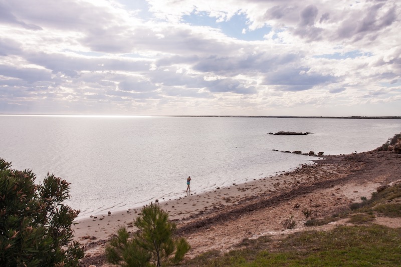
Su coming out the water at Ceduna Beach
With a plan to head down the “seafood” coast to Port Lincoln, we warmed the engine but as we moved off noticed a squeaking sound from the camper that we had heard when we pulled up. At first glance it appeared to be a loose wheel; bad enough, but we were horrified to realise the wheel bearing was completely shot. A roadside mechanical inspection through the RAA, some helpful tips from an itinerant sometimes local towing “The Bearded Clam” and we made a very slow journey across town to the A1 caravan park to set up camp for the night before mechanical surgery on True Blue first thing in the morning.

One of the more unusual mobile homes we encountered on the trip
<< Previous Chapter — — —Next Chapter >>